03 | computer-controlled machining MY BIG MAPS OF CHANDIGARH & DHAKA BY ALBERT CHING This week was an exploration of making big maps with the help of the Shopbot and also the laser-cutter. For city-planners,
map-making is religion but often times they sit 2-dimensionally on powerpoint screens. This week's lesson opened the possibility
that physical, tangible maps could be made relatively quickly and used as a centerpiece for discussion, something I tested out
by bringing my acryllic maps to a meeting with professors with good success. A HUGE THANKS to Tom and John who worked tirelessly
to not just help make my maps happen but to help everyone else in what were two extremely busy weeks - they are the heroes for me
this week.
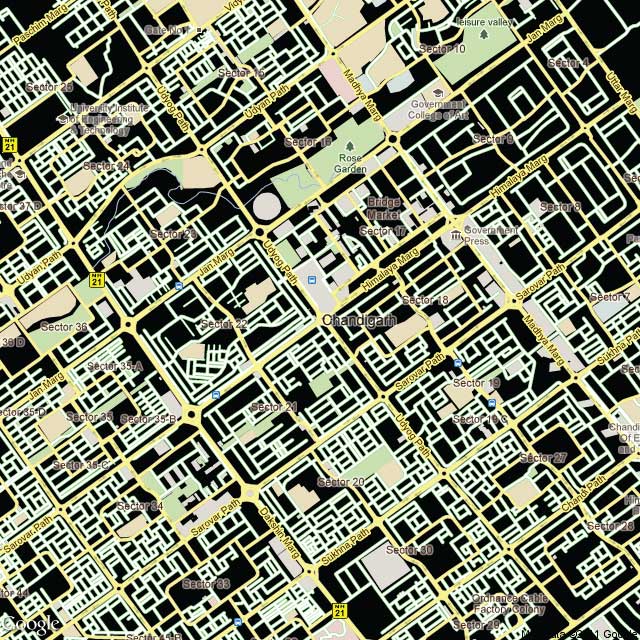
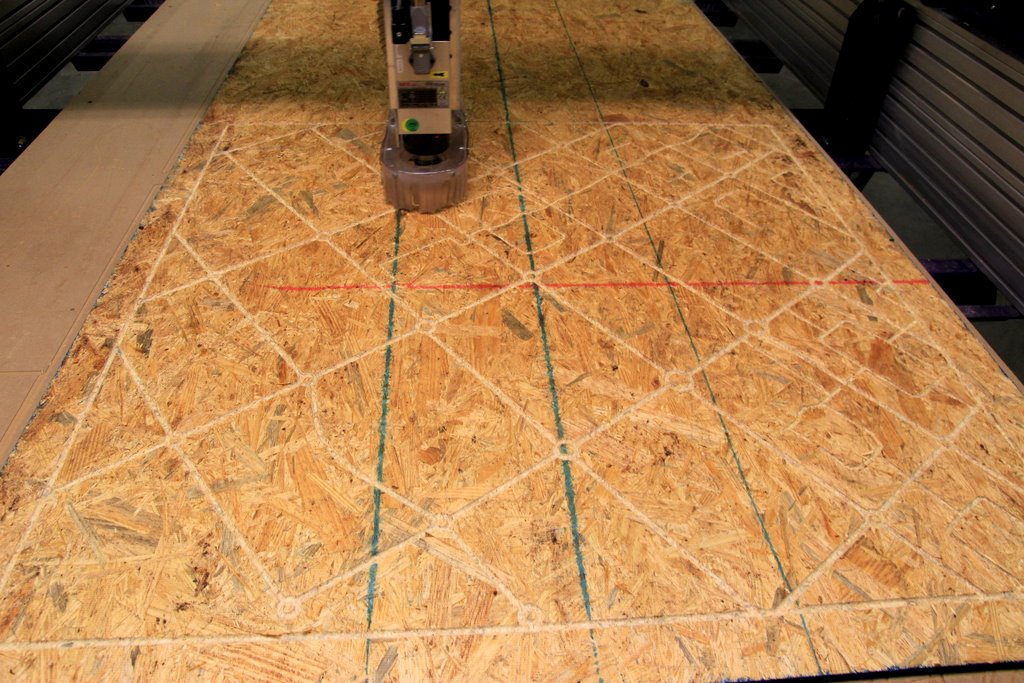
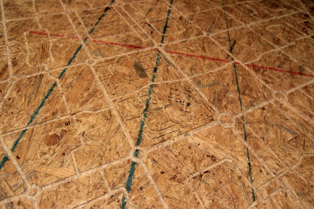
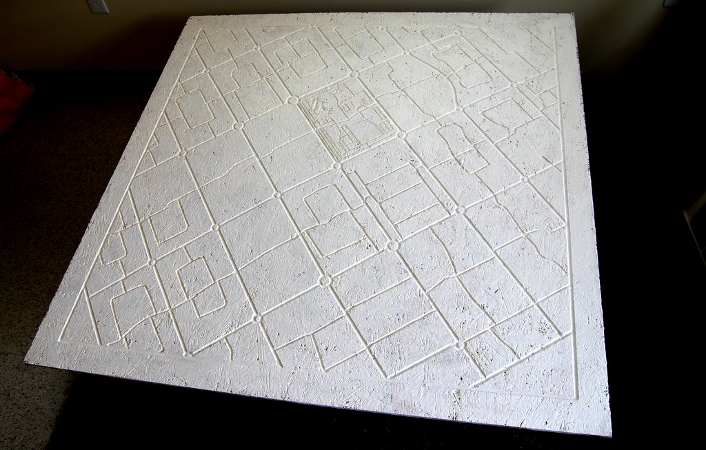
MY BIG (4' x 4') OSB MAP OF CHANDIGARH Chandigarh is the most famous and perhaps only true planned city in India -- it was designed by Le Corbusier and created as a new
model capital of India in its early years after indepdendence. The city itself was laid out in 63 sectors, each carefully dimensioned with
not just transport efficiency in mind but also social cohesion (at least modeled on European social structures). Each sector had its own
amenities, a park, public space, wide streets,
etc. It was also geometric and spacious for Indian standards which made it ideal for testing
in on the Shopbot.
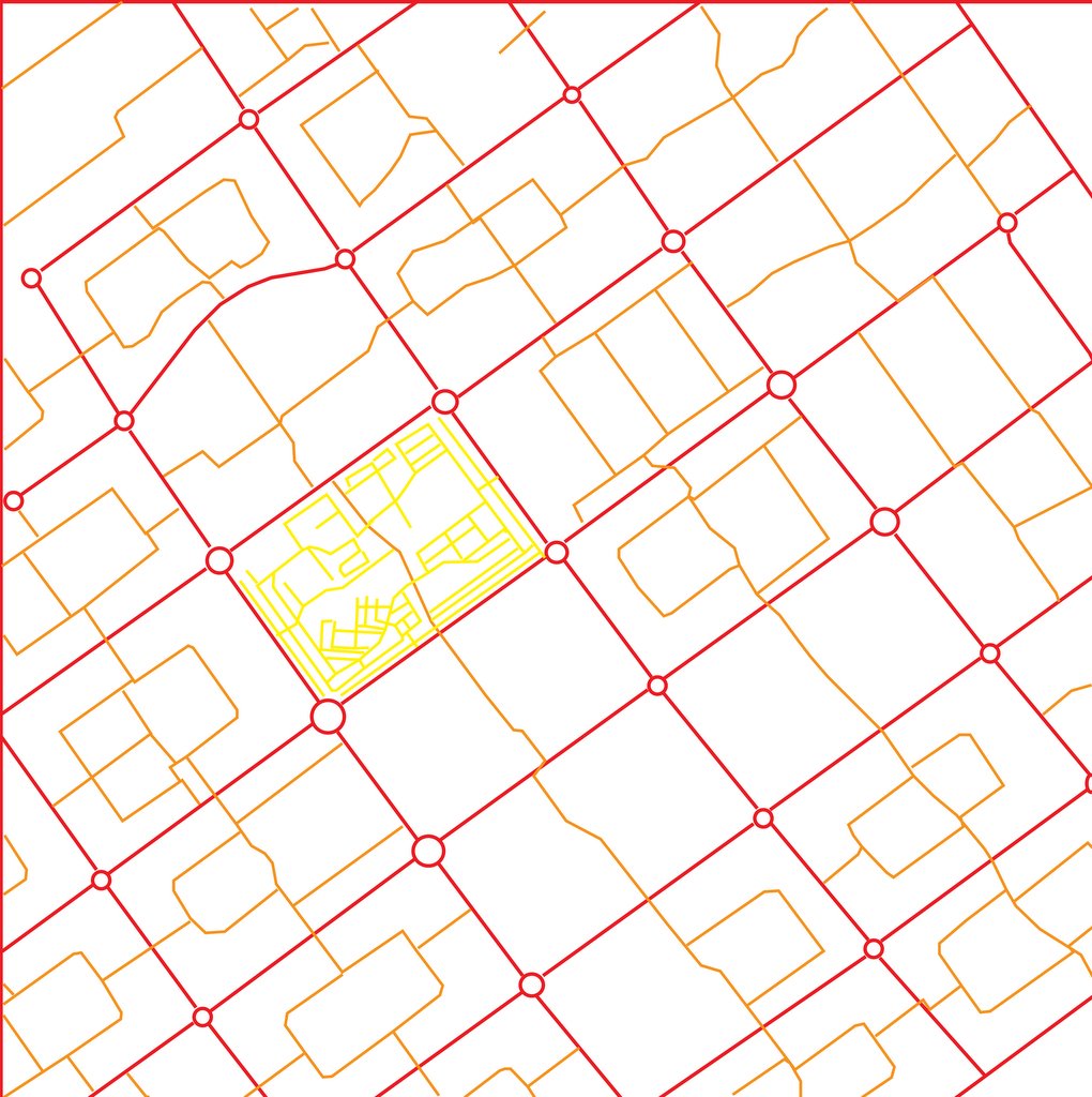
The workflow Stylized Google map of Chandigarh
Traced map in Adobe Illustrator
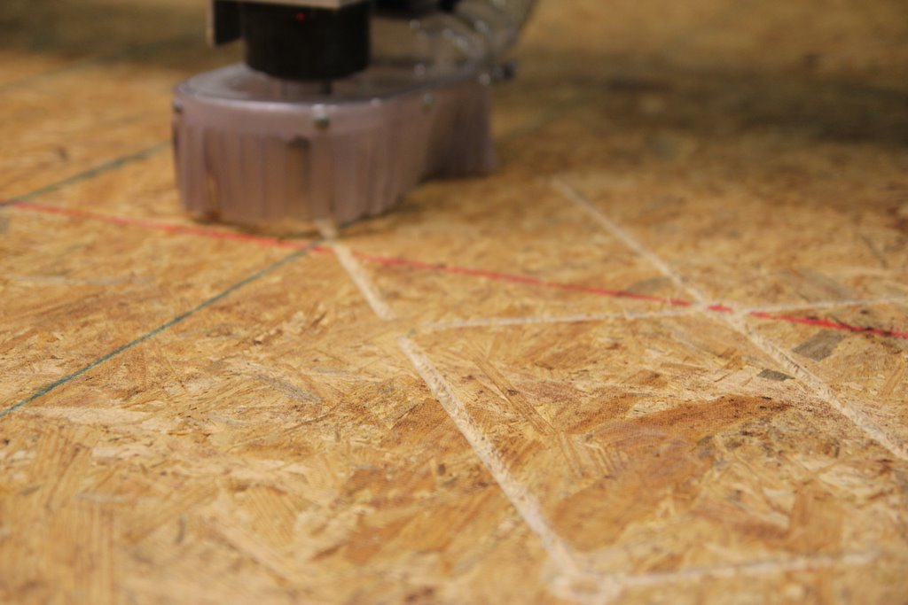
Shopbot milling
I
wanted to translate the different color lines, which represented different street widths into the shopbot so I created 3 seperate .dxf files
which would be used with 3 differents sized nmills - a 3/8ths inch, a 1/4 inch and an 1/8 inch. This process was relatively easy (with lots of
help and inspiration from Tom). The trickiest parts to milling are the power and speed settings for each nmill which works differently depending
on the material -- b/c I had Tom's help, I just made one pass and it worked.
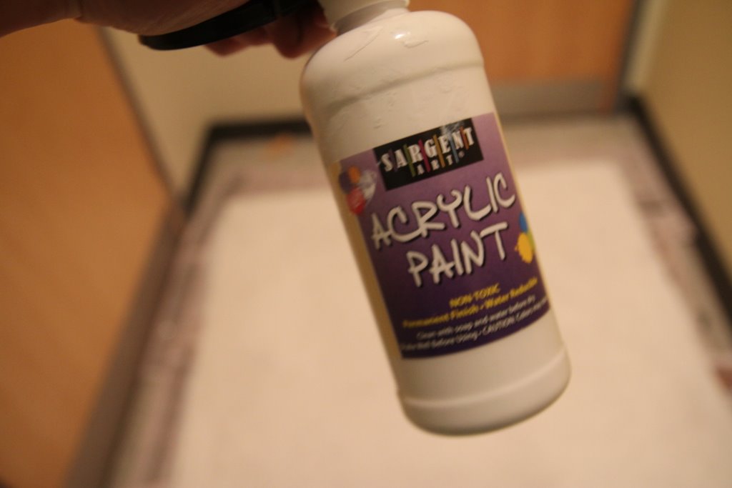
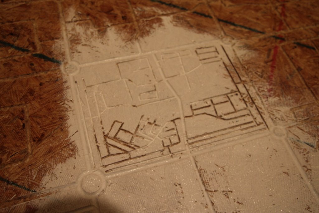
Finishing The OSB board has a certain charm to it but I wanted the lines that I etched to be more prominent so I decided to paint it with some white
acrylic paint which worked pretty well.
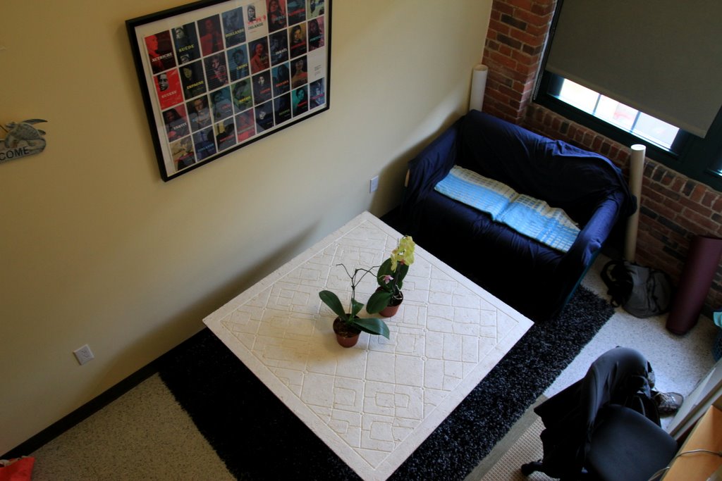
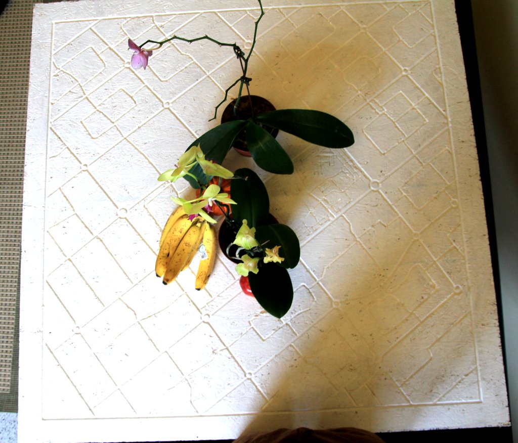
Big Map Table Top
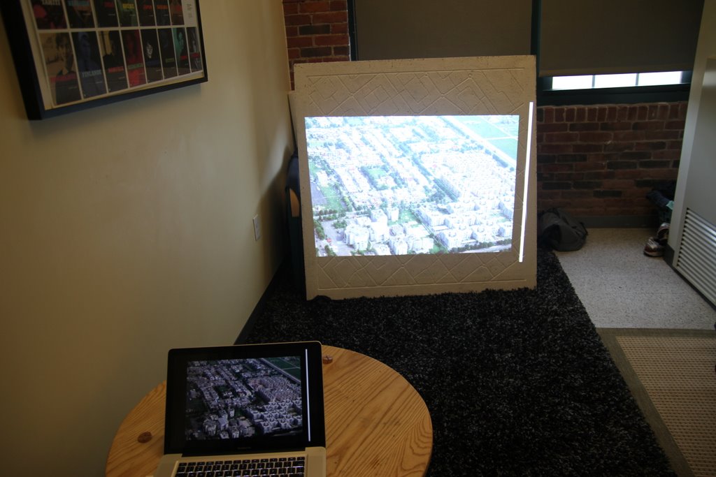
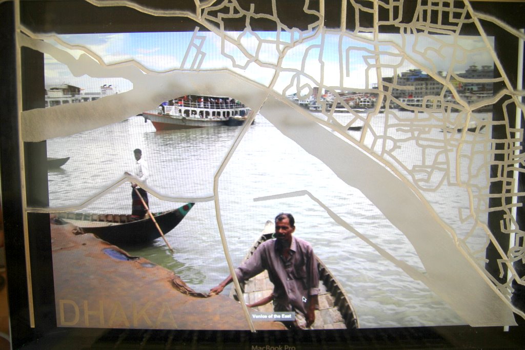
Recombining the Digital and Physical Worlds
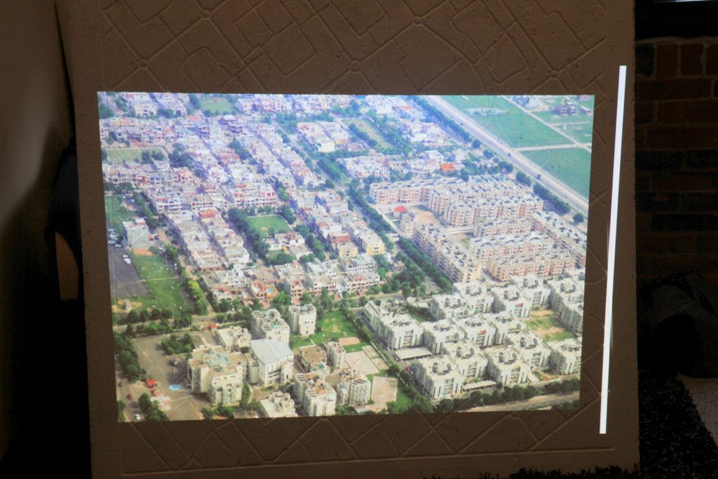
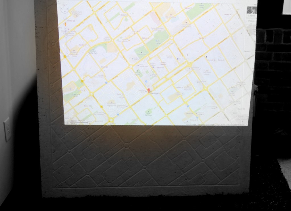
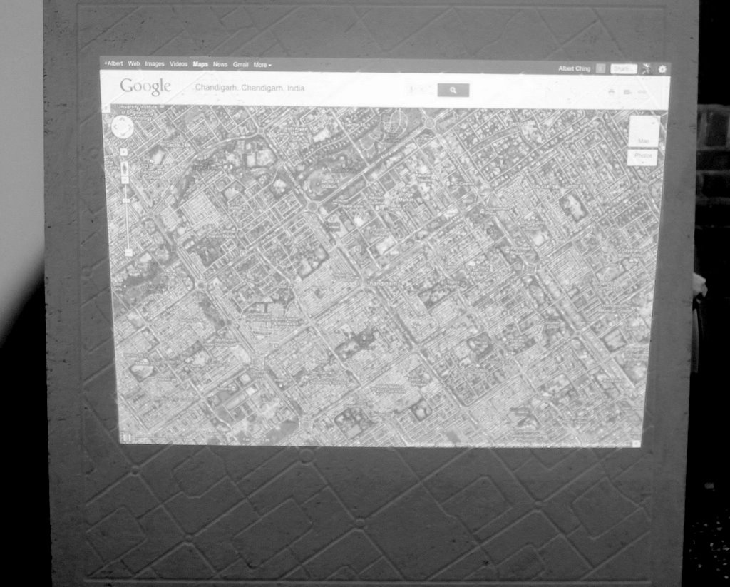
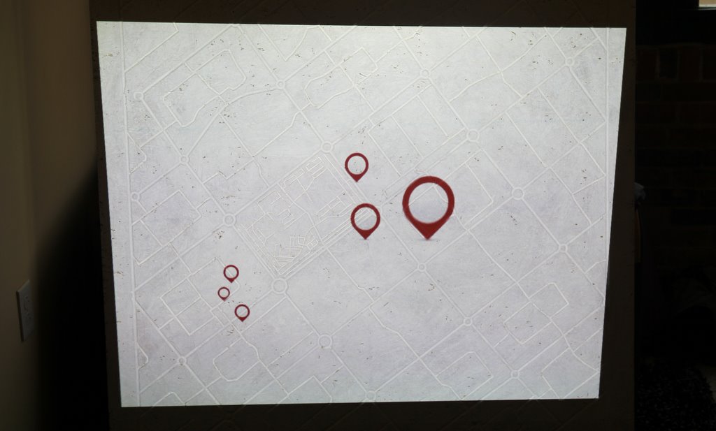
I wanted to explore whether or not I could recombine the digital and physical worlds by projecting digital information on top of my big map -
and if that was a compelling user experience. In some respects, it added an add'l layer of complexity that a 2D map does not and can create
a physical/digital layer of information that I think is evocative. In a testament to the accuracy of the computer-controlled milling, I could fairly
accurately layer the digital street grid right on top of the physical one that I milled.
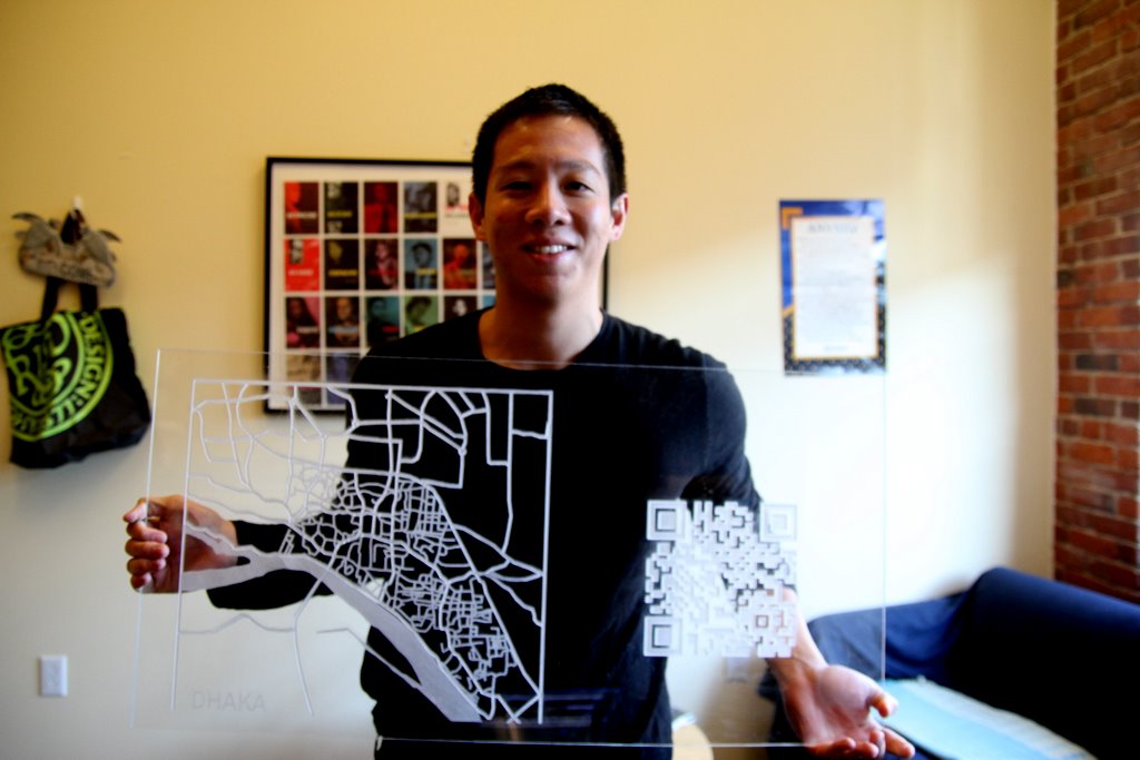
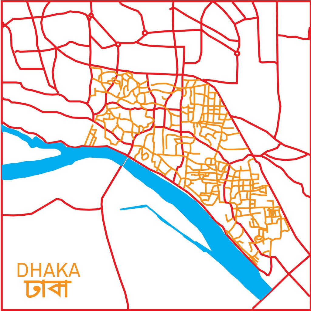
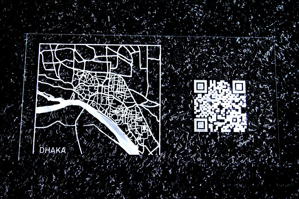
MY (18" x 36") ACRYLIC MAP OF DHAKA My original intention was to etch this map out on the waterjet but after consulting with John, he recommended that I try to cut the map out
on the laser-cutter in acrylic since the street structure was much more chaotic and detailed in Dhaka. I'm very glad that I did. After multiple attempts, the best workflow we discovered was to export the files I created in Adobe Illustrator as bitmaps or pngs and then use Corel Draw to etch them as clipart. The quality was better than I expected -- the only unexpected surprise was that it took almost 2 hours to complete on the laser cutter.