Parsing MBTA realtime data with the magic of python
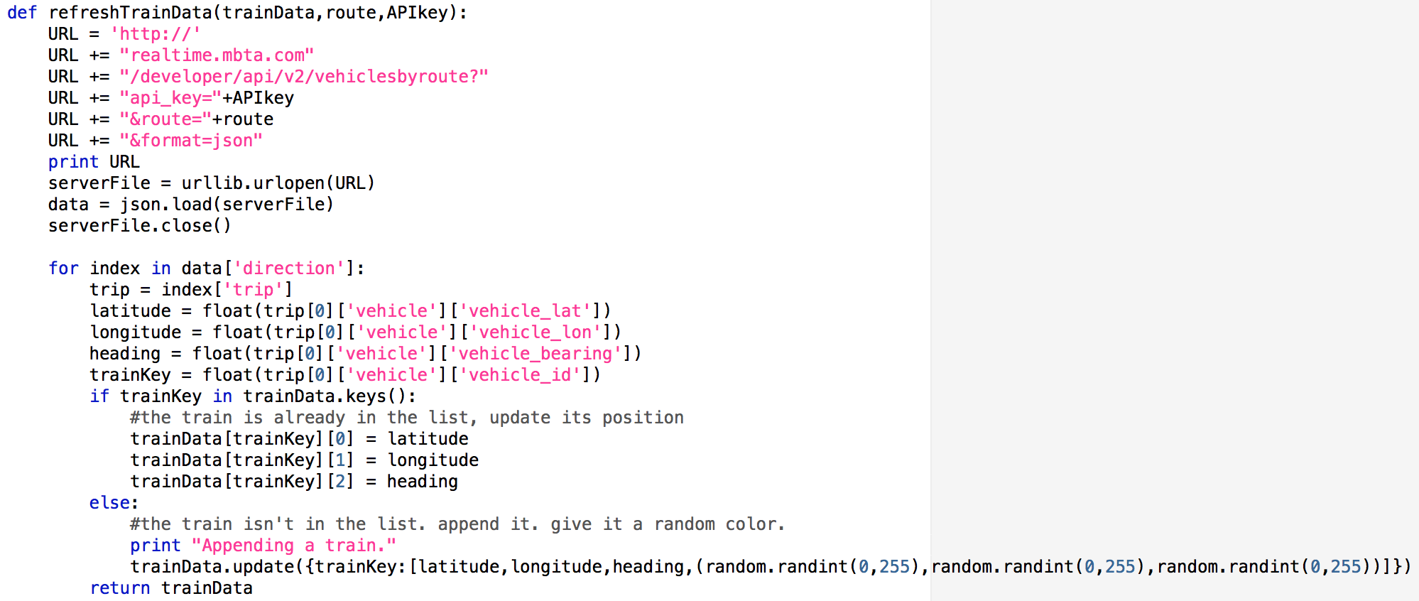
First, I used data from the MBTA realtime feed: see the MBTA realtime data portal for more info. Querying data from it couldn't be easier. As I show above, you give a HTTP request, and the server responds with a JSON object. Since all this has well supported libraries, in only a few lines you have python dictionaries and lists containing all the data. The MBTA provides latitude, longitude, heading, as well as when the timestamp for when those data were collected, so you can make a pretty reasonable interactive map.
Openstreet map
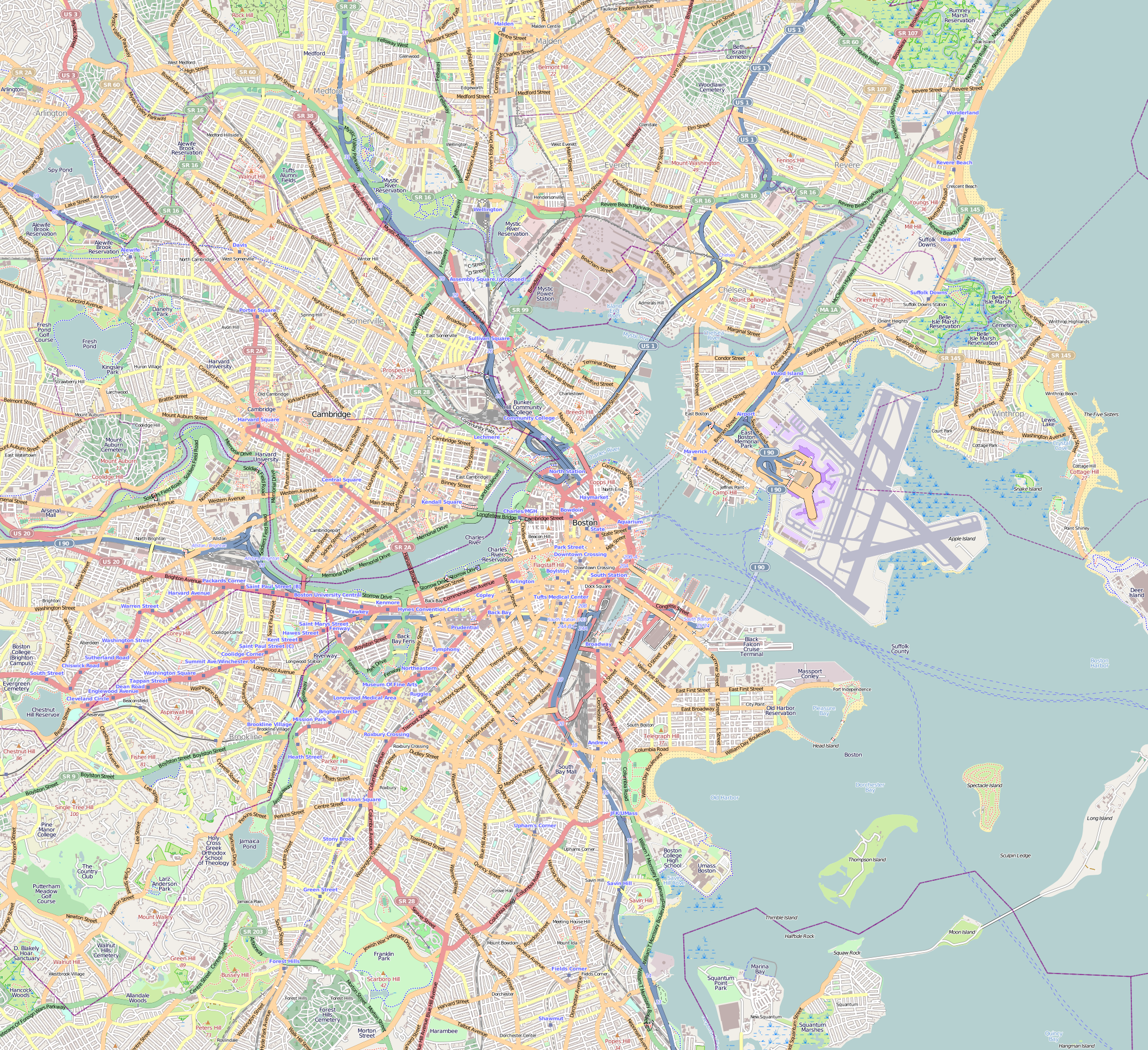
With the location data from the MBTA realtime feed, I then needed something to plot it on. I turned to OpenStreetMap which is a freely available open-sourced mapping community. They let you define a X-Y area defined by latitude and longitude and the download PNGs of that area directly. This was exactly what I needed just to put dots of the trains on a map. An aside on mapping however: You may have heard that the world is in fact a sphere and not a 2D plane. Worse than that, the world is actually an oblate spheroid and not a sphere. This means that any representation of the Earth as a 2D surface (such as a map) is necessarily wrong. While I think my approach is reasonable for a small area, this starts to breakdown with anything large. For more details, check out WGS 84, which is the "real" coordinate system for the Earth. This seems to me to be a non-trivial problem, and I haven't found any good libraries to deal with it.
The final program
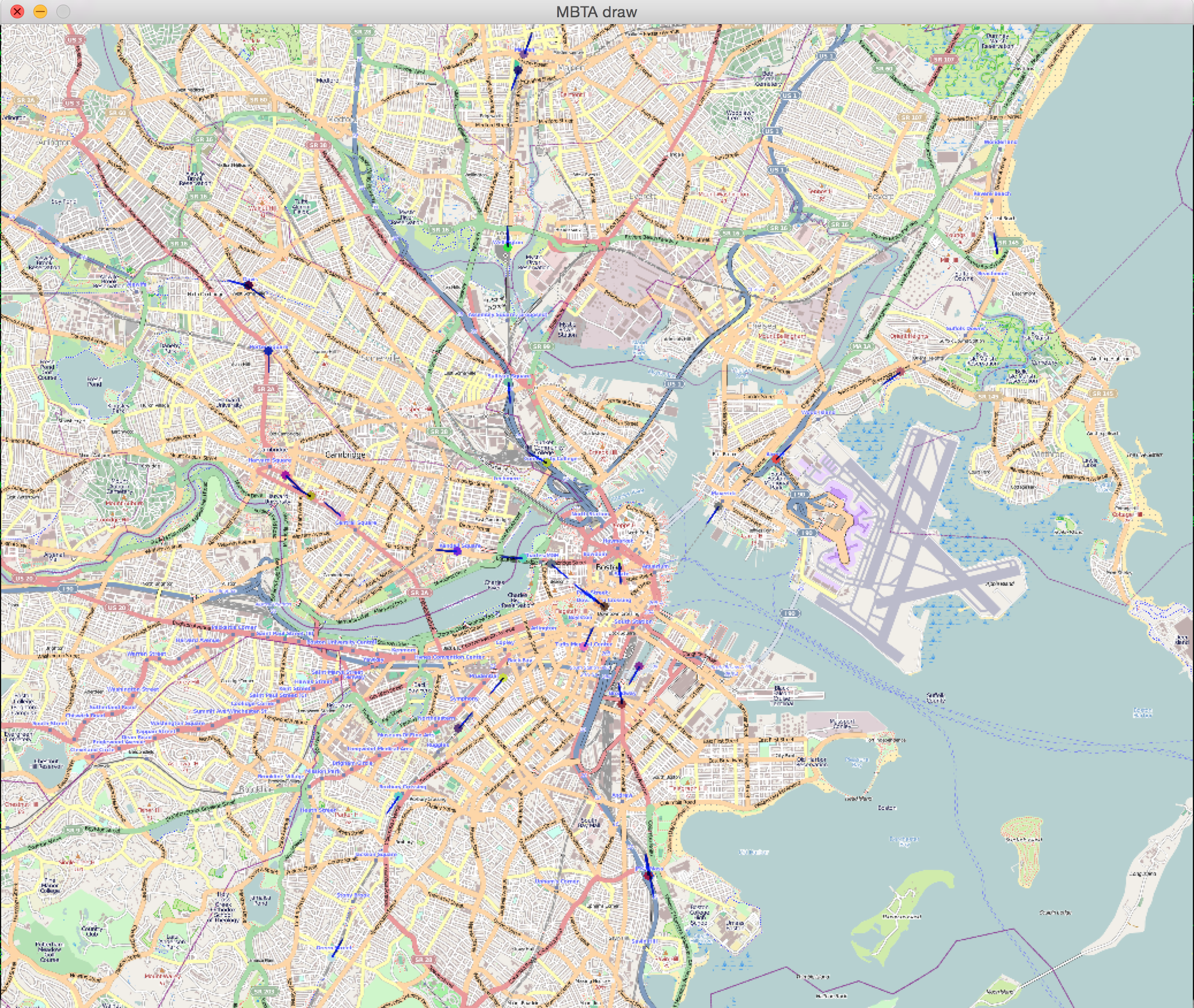
The final program then brings the realtime data together with the open street map to draw some spheres where the trains should be. I also add a line to indicate the heading of the train. Todo: Try and design a large format LED matrix, which can be a bit non-trivial.