The Integrated Desert Navigation and Alert System is a versatile solution designed to assist users in remote desert environments by combining navigation, location broadcasting, and emergency alerting. This system integrates a GPS module for real-time positioning, an RFID scanner for local navigation, and BLE for wireless communication with rescuers. It features an OLED display for user feedback and audio cues for guidance, all powered by a solar-charged battery for reliability. By connecting wired and wireless nodes (RFID, GPS, BLE) with network addresses and utilizing local input (RFID and sensors) and output devices (display and buzzer), the system effectively meets the requirements of design, build, and connect functionalities.
Islam's introduction to Egypt began in 641 CE during the Rashidun Caliphate under Amr ibn al-As, following the conquest of Byzantine-ruled Alexandria. Egypt swiftly became a central hub of Islamic learning, governance, and culture, blending its ancient traditions with Islamic principles. The establishment of Al-Azhar Mosque in 972 CE solidified Cairo as a beacon of Islamic scholarship, influencing the faith's intellectual and spiritual growth across the globe.
The Qibla, the direction Muslims face during prayer, embodies unity and devotion by orienting worshipers toward the Kaaba in Mecca, the spiritual heart of Islam. This alignment reinforces the collective nature of the Muslim ummah, symbolizing shared faith and submission to God. Historically determined using celestial navigation, the Qibla serves as both a physical and metaphysical axis uniting Muslims worldwide in their daily acts of worship.
The development of the Qibla finder represents the convergence of ancient knowledge and modern technology. Early Islamic astronomers relied on precise calculations and instruments like the astrolabe to determine the Qibla. Today, digital tools leverage GPS and algorithms to provide real-time directional accuracy. This innovation reflects Islam’s enduring adaptability, merging tradition with technological progress to facilitate spiritual practice in a globalized, interconnected world.
With Cairo being called the City of a Thousand Minarets, its hard to pick one mosque to design the PCB after. However, my favorite one is the Hakim bi Amr Allah Mosque, built under the Fatimid Caliph who was notoriously known for being a megalomaniac who led ambitious projects under his enigmatic rule.
I decided to program a PCB designed after the Al-Hakim Mosque in Old Cairo to be a Qibla Finder.This is a remix of my series of me figuring out similarities between ancient Egyptian structures and modern circuit boards. However, this was done entirely different, even more different than the previous PCB. It was on a mosque’s architectural plans, so it was much more different. The idea of finding true similarities has been diminished, now its more of designing cool-looking PCBs.
Obtain Map and Temple Plan: After finding the map site, find a high-resolution temple floor plan and ensure it has clear lines for vectorization.
Vectorize Image: Trace the cleaned-up map in a vector tool to convert it into paths in Illustrator. Ensure the lines are crisp and save as a black-and-white PNG.
Import into KiCAD, Add Components, Make Routes: In KiCAD’s PCB editor, import the PNG, adjusting scale and line thickness to match the temple's outline then make it functional.
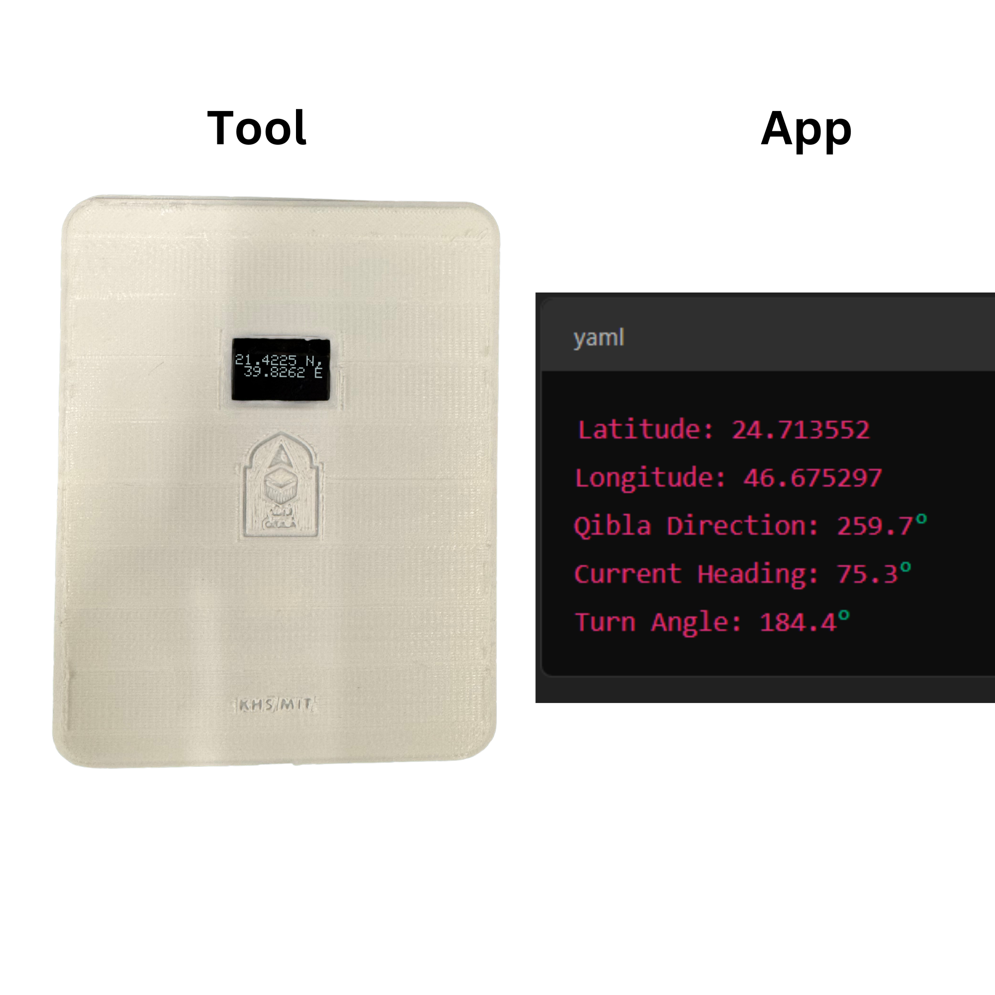
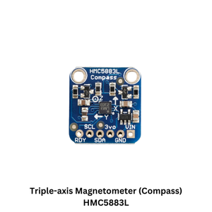
This Qibla Finder system leverages the NEO-6M GPS module to determine the user’s exact latitude and longitude, providing a starting point for Qibla direction calculations. The HMC5883L magnetometer acts as a digital compass, measuring orientation to ensure the device aligns accurately with geographic north. The ESP32 microcontroller serves as the system’s brain, integrating GPS and compass data to compute and display the Qibla direction. Finally, the 0.96” OLED I2C display presents the output visually, offering a clear and user-friendly interface. Together, these components create a portable, precise, and efficient Qibla Finder ideal for real-world applications.
This schematic integrates an ESP32 microcontroller with a Neo-6M GPS module, HMC5883L compass sensor, and an OLED display, creating an efficient system for a Qibla Finder. The GPS module provides the device's geographic coordinates, while the compass sensor determines orientation by measuring Earth's magnetic field. These inputs enable precise Qibla direction calculation relative to the user's location and facing direction. The OLED display visually communicates the direction to the user. The ESP32’s Wi-Fi capabilities and low power consumption make it ideal for a portable, real-time Qibla Finder, combining accuracy and accessibility for seamless use in modern applications.
Just like how they made it a hand-held device back then, I wanted to do the same thing. However, I learned many lessons on my way to making the casing for this. First off, this is when I realized there was so much unneeded PCB space in this project to be practical. It’s functional, but it could have been smaller if I wasn’t doing a map and solely focusing on the functionality. It ended up being a big box with a small screen at the middle top.
I tried to use up the extra space on the casing with a emblem of your typical Qibla finder. However, that came out horribly due to the way I oriented it for printing after the design to avoid using supports (big mistake) and put its face on the tray. This led to the engravings being a nightmare to polish up and inferior results.
Lesson learned, for the final project, make sure engravings are always NOT on the printing bed.
The Qibla Finder successfully fulfills the requirement of "writing an application that interfaces a user with an input and/or output device" by integrating hardware components and software to detect and display the Qibla direction. Using the NEO-6M GPS module, the device captures the user's precise latitude and longitude as an input, while the HMC5883L magnetometer provides orientation data by measuring Earth's magnetic field. These inputs are processed by the ESP32 microcontroller, which calculates the Qibla direction relative to the user's location and alignment. The result is presented on a 0.96” OLED I2C display, offering a clear and user-friendly output interface. This combination of input (GPS and compass data) and output (OLED display) ensures the Qibla Finder is both accurate and efficient, providing a practical, portable solution for determining prayer direction in real-world applications.